Claudia Can’t Sleep
(Claudia can’t draw, either, but that won’t stop this blog from happening.)
Remember when I tried to draw the continental US without looking at a map?
Well now let’s try it with Canada! Apologies in advance. Rough sketch:

Oh gods. Manitoba has an oscillating border, Ontario is NOT SHAPED LIKE THAT, and I think I cut off like 6000 square kilometers from the east coast by Hudson Bay.
Let’s take the rough sketch and refine it a bit, eh?

Yeah, Ontario is still screwed up (the dangly bit that dips down into the US is a lot bigger than in the picture) and I have no idea what happens to the northern part of Nunavut (all I knew is that it breaks up in a triangle-like shape, haha), but I guess it could be worse.
Also, ever notice that a lot of the provinces resemble some US states (or vice versa I guess)?
Think about it:
- British Columbia is like a fat California.
- Alberta is like a stretched Nevada.
- Saskatchewan is North Dakota on its side.
- Manitoba is Minnesota with somewhat straighter eastern borders.
- Yukon is a giant New Hampshire.
- Nunavut is an upside down broken-up Texas.
Also, Canada has a hypothetical four corners like the US (Saskatchewan, Manitoba, NW Territories, Nunavut), but it’s in a super remote area and since the NW Territories/Nunavut boundary hasn’t been totally surveyed yet, they’re not sure if they meet at the corner of the Manitoba/Saskatchewan border.
Oh, Canada.
A STATELY CHALLENGE
Holy crap, it’s a blog not posted at 1 AM!
So while I was doing research today (read: “as R was working hard running my code and I was just sitting there”), I decided to see if I could draw the US and all the continental states from memory. First I made a sketch to see if I could even get close, then I made an actual drawing with ink so you could see all my little screw ups (aka, the entire eastern seaboard).
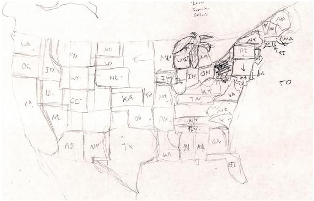
Rough sketch = epic fail.
Apparently, in my mind, the Midwest is an even bigger expanse of nothing than it is in real life, the Great Lakes are a palm tree, West Virginia is a scribble, and New England is experiencing severe continental drift along the state border lines.
So I tried again, using just my rough sketch for reference, and I think this is substantially better:
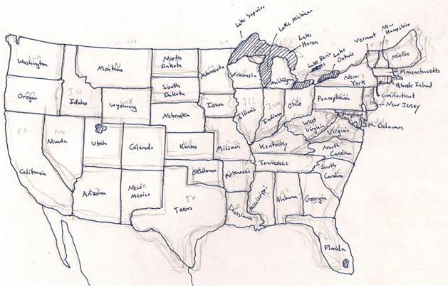
The proportions (and some locations) really start to suck east of the Mississippi River, but at least I didn’t miss anything. Indiana and Ohio look crappy ‘cause I screwed up that general area and just went with it. The rest look crappy ‘cause I don’t know what they look like…in particular, I couldn’t for the life of me remember how the hell West Virginia is shaped, so I just kinda threw it on there where there was a gap in the states yet and called it good. Hahaha, Wisconsin is so deformed, but I got the Great Lakes right (edit: I also just realized I forgot to put the tail on the “g” so it looks like I wrote “Lake Michican.” You’d be surprised how often I forget to complete letters before moving on to the next one. Or maybe you wouldn’t, it is me, after all).
I’d try to draw Canada, but pfft. I know the names of the provinces and territories, I know where BC, Saskatchewan, and Nova Scotia are, but that’s about the extent of my Canadian geography knowledge.
I also have no idea when it was the last time I looked at a US map, Canadian map…or a map of anything aside from the bus routes, for that matter.
So there you go.
Conclusion: I like square states.

